Why Clouds Gather in Layers
Why clouds gather in layers depends on moisture, rising air and stability. Learn what separate bands reveal about the atmosphere, without specialist equipment.
The common mistake in reading a layered sky is to treat every cloud band as one broad sheet. That can hide the real cost: you may miss that separate bands are forming in different conditions and travelling with different winds. Why clouds gather in layers becomes clearer when you consider how moisture and air motion vary with height.
A cloud forms when air cools enough for water vapour to condense into tiny droplets or ice crystals. The sky is not one uniform mass of air. Temperature, moisture and motion can vary with height, creating several places where clouds can form while the air between them stays clear.
Changing air conditions
Air near the ground is affected by the surface below it. Sun-warmed soil, a cool sea breeze, damp woodland and a built-up street can all influence how air moves and how much moisture it carries. Higher up, the air may have a different temperature and humidity, and may move in another direction.
Whether rising air continues upwards depends on buoyancy: a rising parcel tends to keep going if it is warmer and less dense than the surrounding air. If it is cooler and denser, it tends to sink back. The temperature profile of the surrounding atmosphere helps determine which outcome is more likely. Cooling with height does not, by itself, make air rise; it matters in relation to the temperature of the rising parcel and the air around it.
In a stable layer, vertical movement is often resisted. Moist air may spread near such a layer, helping form a broad sheet, while air above remains clearer. The cloud marks conditions suitable for condensation; it is not a solid shelf holding the cloud up.
How layers form
Air can rise when the ground warms it from below, when it is forced over hills, or where air masses meet. As rising air expands in lower pressure, it cools. If it contains enough moisture and reaches the point at which water vapour condenses, cloud can form.
Broad, gentle lifting often favours clouds spread across a wide area. Stronger, localised rising currents can build taller heaps, with rounded tops and brighter edges when sunlight reaches them. Shape is a clue, not a complete explanation: a flat-looking layer can have texture, and a tall cloud can sit beneath a smoother veil.
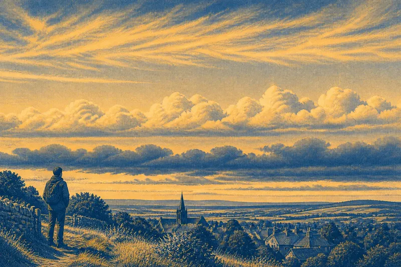
Separate moist regions can produce clouds at different levels. Say a walker sees a low, broken bank above the rooftops and a thin, higher streak. The walker notices that the low bank changes outline as it passes, while the streak stretches and fades in a different direction. The visible result supports the idea of separate cloud layers moving in different winds, though appearance alone cannot establish their exact heights.
Clues in cloud shape
Low clouds often look large and detailed because they are relatively close. They may have dark undersides, ragged edges or lumpy surfaces. Higher clouds tend to look finer and less distinct, appearing as delicate streaks, pale patches or a thin veil through which the Sun still shows.
Apparent size can mislead. A small-looking cloud is not automatically high, and a broad-looking cloud may be near or far away. Compare texture and contrast as well: crisp edges often stand out more clearly in lower clouds, while high cloud can look faint or feathery. Light and background affect what you can see.
Overlap can suggest that one cloud lies in front of another, but perspective makes height difficult to judge. Motion provides another clue: bands moving in different directions or at different speeds are likely in air with different winds. That does not reveal a precise altitude, but it can show that the scene contains more than one moving layer.
What should you look for?
Why are there clear gaps between cloud layers?
The air between layers may be too dry or otherwise unsuited to visible condensation. A gap can also appear as clouds move apart or change shape.
Can cloud layers move in opposite directions?
Yes. Winds can differ with height, so a low band may travel one way while higher cloud moves another. Their changing positions against a building or tree can make this contrast visible.
Does a dark lower layer mean rain is coming?
Darkness often means less light is reaching the cloud’s underside, perhaps because the cloud is thick or the Sun is behind it. Cloud appearance alone cannot settle what weather will follow, so use a local forecast for practical decisions.
Why do layers sometimes look joined together?
Cloud edges may overlap in your line of sight, or one layer may spread until it blends visually with another. Distance, light and background can hide the gap, so a single glance may not distinguish separate clouds.
Light and the horizon
Light affects which layers stand out. Near sunrise or sunset, low-angle light can sharpen some contours and tint clouds, while higher clouds may catch the light after lower ones darken. At midday, pale cloud against a bright sky can be hard to separate from its background. Never stare at the Sun; look towards the surrounding sky or choose a shaded position.
The horizon can hide lower clouds behind buildings, trees or hills. A layer may seem to begin at a roof simply because the nearer part is blocked. If the band appears again in a gap between buildings, that change in visibility is a clue about the obstruction, not evidence that the cloud rests on the ground.
Useful viewing choices
You do not need to sketch the sky or keep returning to one fixed viewpoint to notice layers. Choose a spot with an open view and a clear landmark, such as a roof edge or tree crown. Compare cloud texture, position and direction against that landmark while you are there. Treat height as an estimate rather than a measurement.
- If one band has a crisp, lumpy underside while another looks fine or streaked, treat them as possible separate layers; if the contrast is hidden by glare, wait for a clearer view rather than assigning a height.
- If two bands shift in different directions relative to a roof edge, infer that winds differ with height; if their motion is hard to distinguish, keep their direction uncertain.
- If a cloud seems to start at a hill or building, check whether it continues above a nearby gap; if it vanishes behind the obstruction, do not mistake the blocked view for contact with the ground.
- If a clear strip separates cloud bands, treat it as air without visible cloud; if the gap closes, allow for changing cloud shape instead of assuming a permanent boundary.
- If cloud colour changes near sunset, use shape and movement as well as colour; if the Sun’s glare obscures detail, look away from it and reassess from shade.
- If a lower cloud darkens, consult a local forecast before making weather plans; if no forecast is available, avoid treating darkness alone as a reliable rain signal.
These choices help keep observation grounded. Cloud names can be useful shorthand, but they are not a test you need to pass, and cloud appearance cannot supply an exact height without instruments.
Why clouds gather in layers
Why clouds gather in layers comes down to separate regions of air with different moisture, temperature and motion. Buoyancy and atmospheric stability help determine where rising air can continue upwards or where vertical movement is resisted; condensation then makes some of those regions visible as cloud.
When two bands share the same view, they need not share the same wind or formation conditions. Notice their texture, the space between them and how each sits against the landscape. Those clues turn a layered sky from a single grey ceiling into a visible arrangement of changing air.